
‘Plan shewing the Course of the Roman Wall called Grime’s Dyke raised along the Isthmus, between the Forth and the Clyde, in the Reign of Antoninus Pius’, from The Military Antiquities of the Romans in North Britain, Vol. II
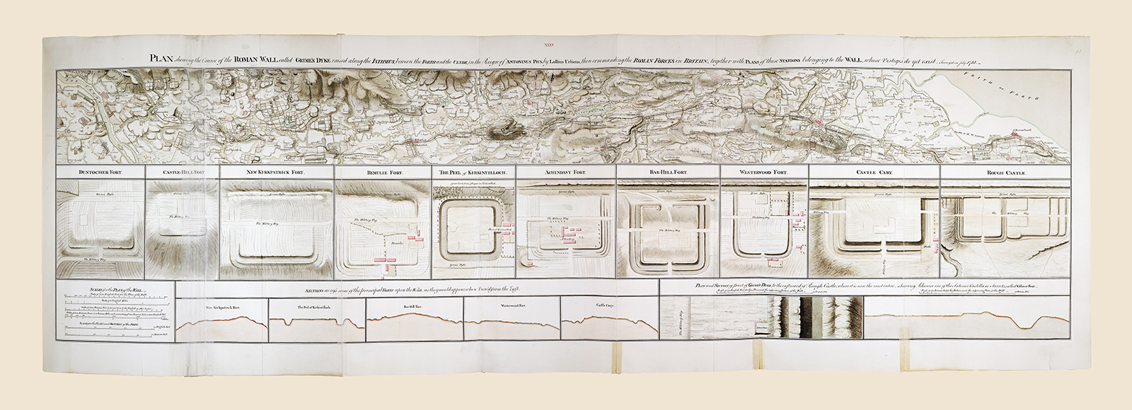
Drawn up in 1773, this little-known manuscript map traces the entire course of the Antonine Wall, together with plans and sections of several of its associated forts. Making use of the knowledge of the ground accumulated during the Military Survey, Roy’s plan maps his reconstruction of Roman antiquity onto the contemporary Scottish landscape. What results is a complex overlaying of the past and the present and of the various forces that had shaped Scotland.
1773
Pen, ink and watercolour
Explore more...
-
Location
Central Scotland -
Location
Strathallan 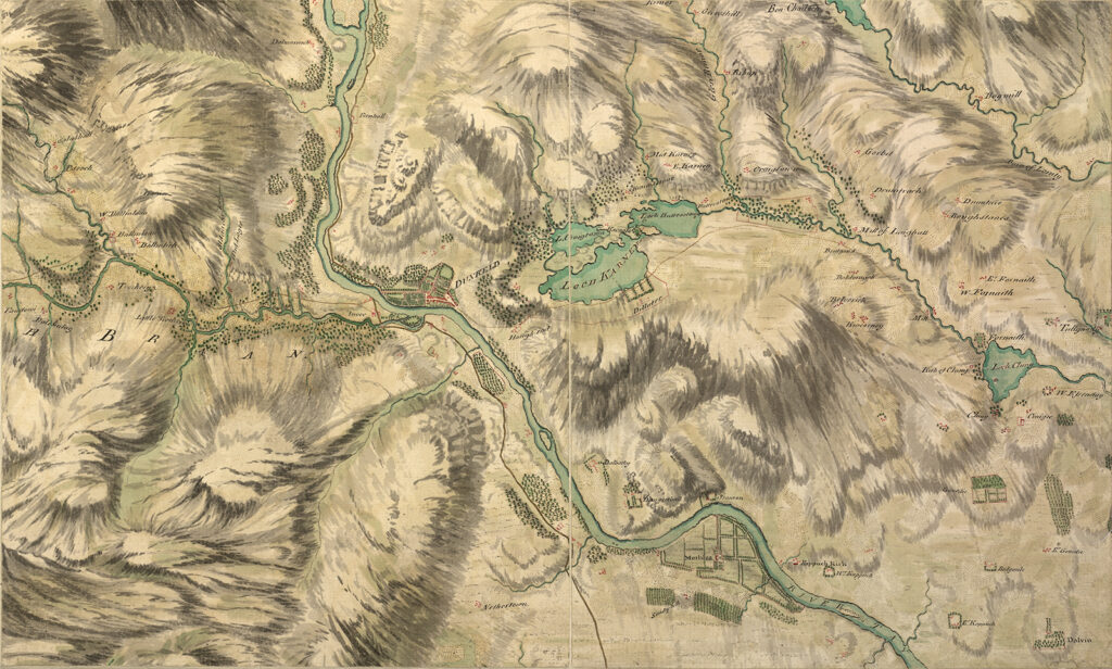
Object
A sheet of the Fair Copy